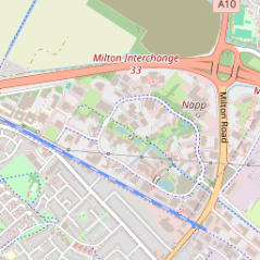
Get Tiles
Retrieves a specific map tile image based on the provided location coordinates and zoom level. This endpoint accepts x and y coordinates, which represent the tile's position within the grid at a specified zoom level. The zoom level parameter controls the image’s scale, where a higher zoom level provides a more detailed, closer view of the area, and a lower zoom level offers a wider, less detailed perspective. Tile coordinates can be obtained using the longitude and latitude of the location there are tools and formulas that can be used to convert the information.
Syntax: see 'CCall Structure
Type = 'GET'
|
'https://connect.cambrionix.com/api/locations/v1/tiles/Z/X/Y.png' \ |
| Output | Description |
|---|---|
| Z | (integer): The zoom level for the image, where higher values increase detail. |
| X | (integer): The x-coordinate of the tile within the grid. |
| Y | (integer): The y-coordinate of the tile within the grid. |
Response
An image of the map location as a png file.
Example
curl -X 'GET' \
  'https://connect.cambrionix.com/api/locations/v1/tiles/14/8198/5394.png' \
  -H 'accept: image/png' \
  -H 'Authorization: Bearer eyJhbGciOiJSUzI1wdQ'
Errors
If there is an error in the API method then JSON-RPC Error Object a will be returned